

Traceability
Connect a field to the operations and evidence recorded against it.
Client work
Live field passportMobile product in developmentVANTREXIS is helping Hartolit connect precision agricultural work with a verifiable digital history for every field. The NFT-based digital field passport is already live and used to certify real field operations, linking completed treatments with structured evidence and blockchain-backed verification. We are now extending that foundation into a mobile product for day-to-day field management, operations, and certification.
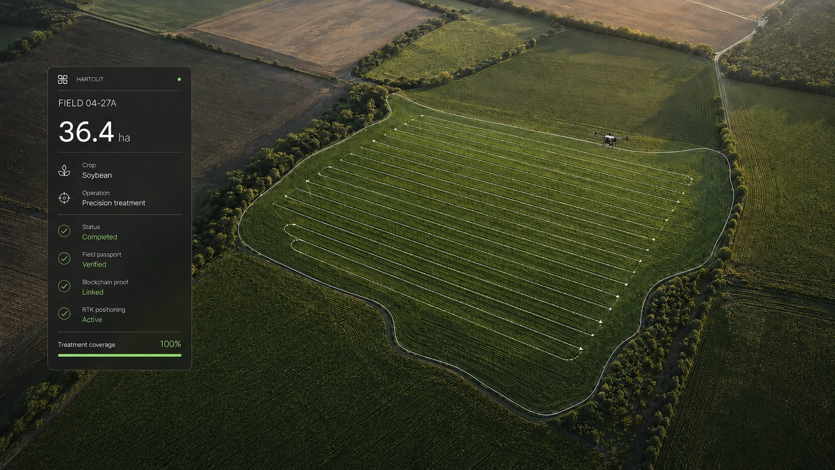
The challenge
Treatment records can be distributed across documents, operators, equipment, and systems. That fragmentation makes it harder to establish a reliable history of what happened on a field, when it happened, and who completed the work.
Connect a field to the operations and evidence recorded against it.
Make the operational history understandable to the people who rely on it.
Preserve a verifiable record of completed agricultural work.
Live solution · In use
Hartolit is already using the NFT-based digital field passport to create verifiable records for completed agricultural operations. Field activity can be associated with structured evidence and a blockchain-backed record, creating a persistent history that supports certification and future operations.
A persistent identity for the agricultural area.
A treatment or precision field activity takes place.
Relevant parameters and evidence are associated with the work.
The record is prepared as trusted proof of completion.
A durable, architecture-neutral verification layer.
A coherent history that can be reviewed over time.
Selected capabilities
The live field passport connects the identity and area of a field with operation details, treatment dates, providers, equipment, parameters, evidence, and the resulting certification record.
Mobile product · In development
The mobile product builds on the field-passport infrastructure already in use, bringing field history, operations, and verification into a practical day-to-day interface. The screens below are product concepts, not a released application.
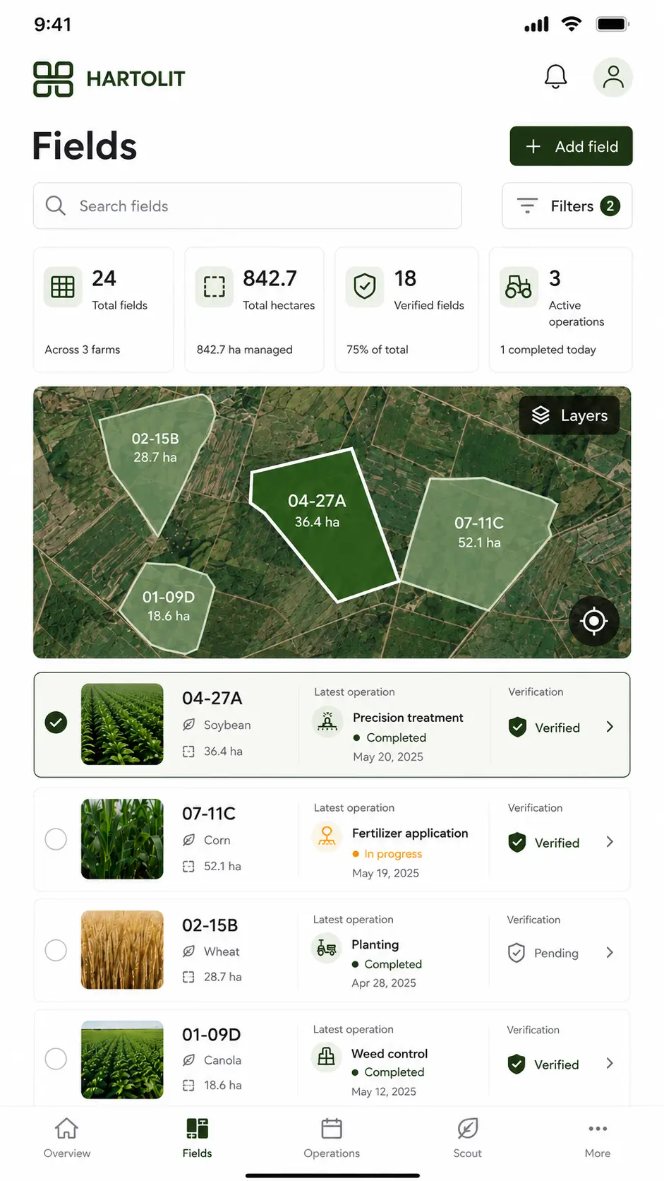
A map-led overview of managed fields, active operations and verification status.
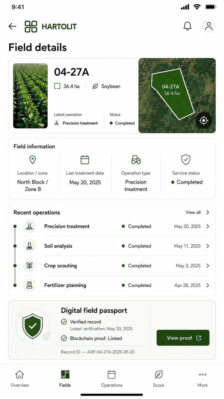
Field identity, operational history and verification in one working context.
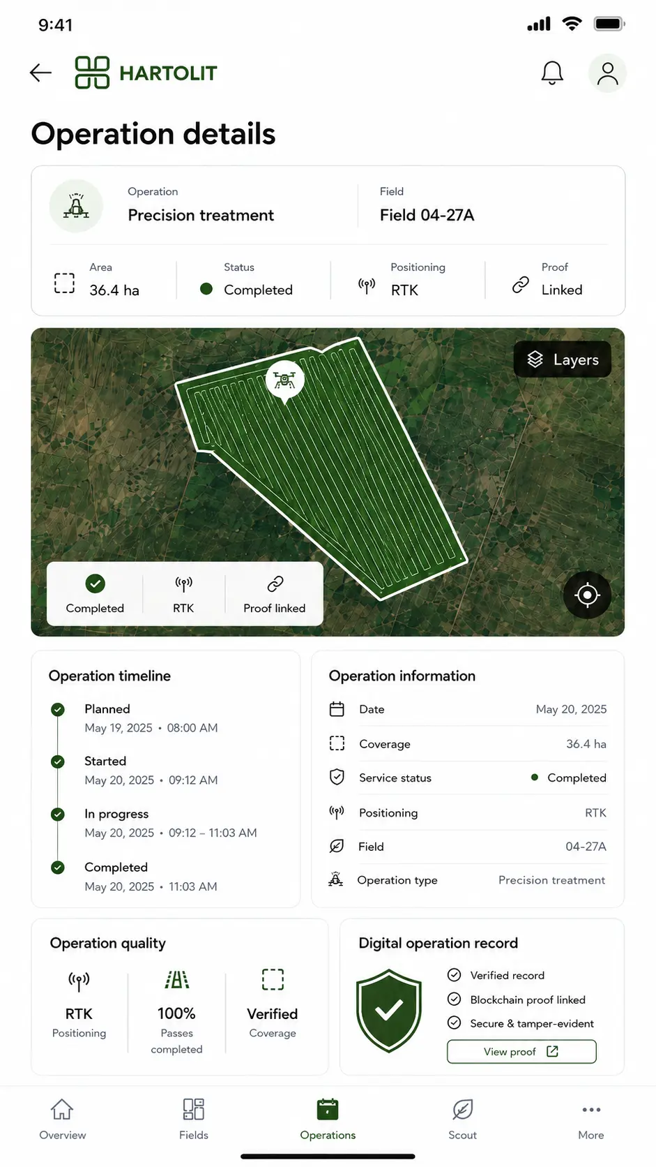
A traceable precision-treatment workflow connecting planning, RTK execution and proof.
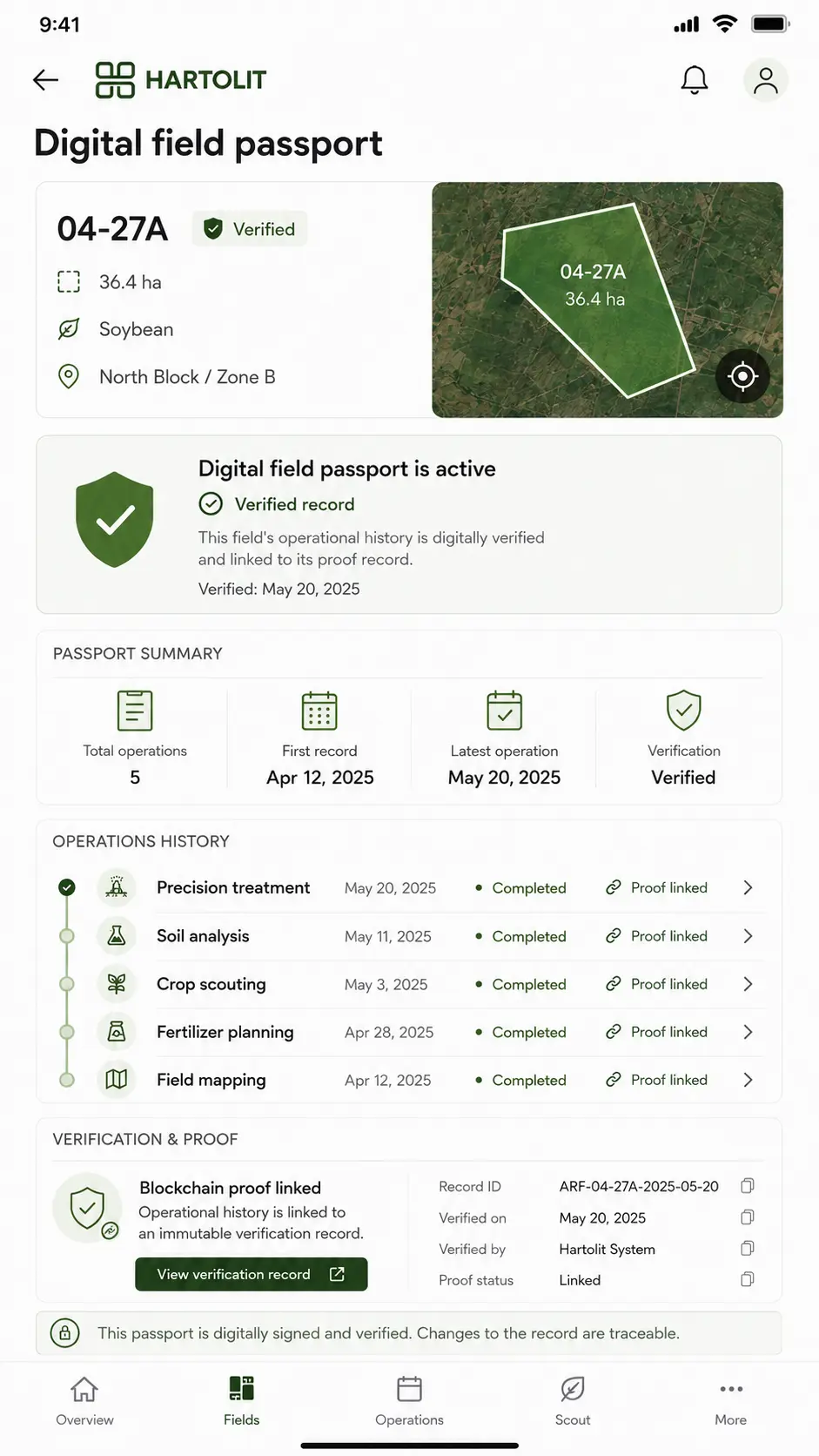
A persistent operational record connecting field history, verification and linked proof.
Technology & architecture
Hartolit combines an operational field-passport layer already in use with a broader mobile and telemetry architecture now being developed around it. The stack is intentionally split between the implemented verification system and the next product layer for field operations, geospatial data and drone telemetry.
Live solution · In use
A blockchain-backed verification layer that connects structured field-operation data with persistent integrity proofs and public record verification.
Typed workflows for capturing field, treatment and evidence data.
Non-transferable field-passport certificates with role-controlled issuance and on-chain integrity anchors.
Contract controls built around deterministic issuance, role boundaries and duplicate-record protection.
Operation payloads can be fingerprinted deterministically, linked to distributed metadata and re-verified against the recorded hash.
Wallet connectivity and contract interaction for issuance and verification workflows.
Product architecture · In development
The next product layer brings fields, treatments, drone operations, geospatial context and verification into one operational mobile workflow.
Cross-platform field operations with native device access and a shared application codebase.
Vue 3 · TypeScript · Ionic · Capacitor · Pinia
Target operational APIs and live state synchronization across field and mobile workflows.
NestJS · REST APIs · WebSockets · PostgreSQL
Field polygons, treatment routes, spatial operations and coverage analysis.
PostGIS · MapLibre · GeoJSON · Turf.js
Adapter-based ingestion for telemetry, operation files and vendor integrations.
Drone Integration Layer · MQTT · AWS IoT Core · MAVLink-compatible ingestion
Operational state, spatial records and durable evidence storage separated according to data type.
PostgreSQL · PostGIS · Amazon S3
Next product architecture · In development
Drone and field activity → normalized operational record → mobile workflow → verification → Digital Field Passport
Engineering considerations
The product direction has to connect real-world field activity with a digital record without obscuring the people, evidence, or operational context behind it.
Explain the value of verification without making unsupported claims about the underlying chain, token standard, or wallet design.
Keep technical infrastructure behind workflows that make sense to agricultural operators and customers.
Support an active field-certification solution while shaping a mobile experience that is still in development.
Have a similar challenge?